
Hunkered down in a Santa Ana auto repair shop, the suspect wouldn’t respond to officers’ demands to give himself up.
The man hiding from police had been seen at about 11 a.m. on Sept. 17, allegedly carrying a gun and entering a 7-Eleven on 1st Street. When police arrived, the man ran from the convenience store and took cover at the back of an auto body shop up the street.
Barricaded and possibly armed, the Santa Ana PD called the Orange County Sheriff’s Department Aviation Support Unit for an assist, and the team brought with them a new tool:
An Unmanned Aerial Vehicle (UAV).
A helicopter that is part of the OCSD’s Duke fleet assisted from above, but the UAV – operated by the Air Support Bureau’s Chief UAV pilot Jer Kahala – was able to get better angles into the target business by hovering 15 feet above the ground, giving the SAPD SWAT Incident Commander a tactical advantage with clear views inside the auto repair shop garage. The OCSD was able to provide a side-by-side view from Duke’s camera downlinked to the command post and the live view from the UAV.
The UAV especially proved valuable when the Duke airship had to peel off from the scene to refuel during the 5-hour call.
The suspect eventually was arrested without incident.
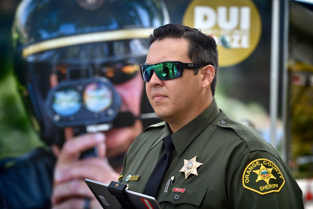
OCSD Dep. Kyle Ishii, part of the agency’s MART (Major Accident Reconstruction Team), uses special grid software with a UAV to help with investigations of scenes such as serious car accidents.
Photo by Steven Georges/Behind the Badge
“Safety is a top priority with UAV deployments,” Kahala said. “This scenario was a perfect example of how our UAVs and Duke can co-exist in the same airspace with proper communication between pilots to bring peaceful resolution to an intense scenario.”
The OCSD recently launched its Unmanned Aerial Vehicle program, and it already has proven to be valuable regional resource.
The agency recently demonstrated the capabilities of the UAV to command staff members and other personnel during a mock car-vs.-bicyclist scene outside the South Operations substation in Aliso Viejo.
When it comes to major traffic collisions, the UAV will dramatically reduce the amount of time it takes to investigate a scene by chronicling what happened by taking pictures and running them through customized mapping software, said Deputy Kyle Ishii, a member of the Major Accident Reconstruction Team (MART) who is trained to pilot the UAV.
And that will translate to fewer resources needed on the ground and much briefer road closures, said Ishii, who received a license and extensive training to pilot the UAV. Policy requires that two deputies work as a team when they use the UAV.
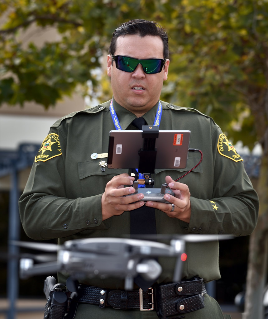
OCSD Dep. Kyle Ishii uses special software to connect to a UAV to photograph and map an area of investigation.
Photo by Steven Georges/Behind the Badge
The new technology was four years in the making.
“To see it up and going now, it’s exciting,” Ishii said.
Prior to the UAV, MART deputies used surveying equipment to electronically measure angles and distances to figure out exactly what happened on the road.
Typical MART calls averaged four to five hours, Ishii said. Now, the calls are expected to last less than half that – or even much shorter. With about 35-40 calls per year, MART greatly will benefit from the new UAV.
The OCSD Air Support Bureau runs the new UAV program, but the OCSD has purchased seven devices that have been distributed to different units. In addition to Air Support and MART, those units are HOT (Homeless Outreach Team), Harbor Patrol, the Bomb Squad, SWAT, and Video Production.
Each division purchased the UAVs under their own budgets for approximately $3,000 each, said Lt. Tom Graham, who runs the Air Support Bureau.
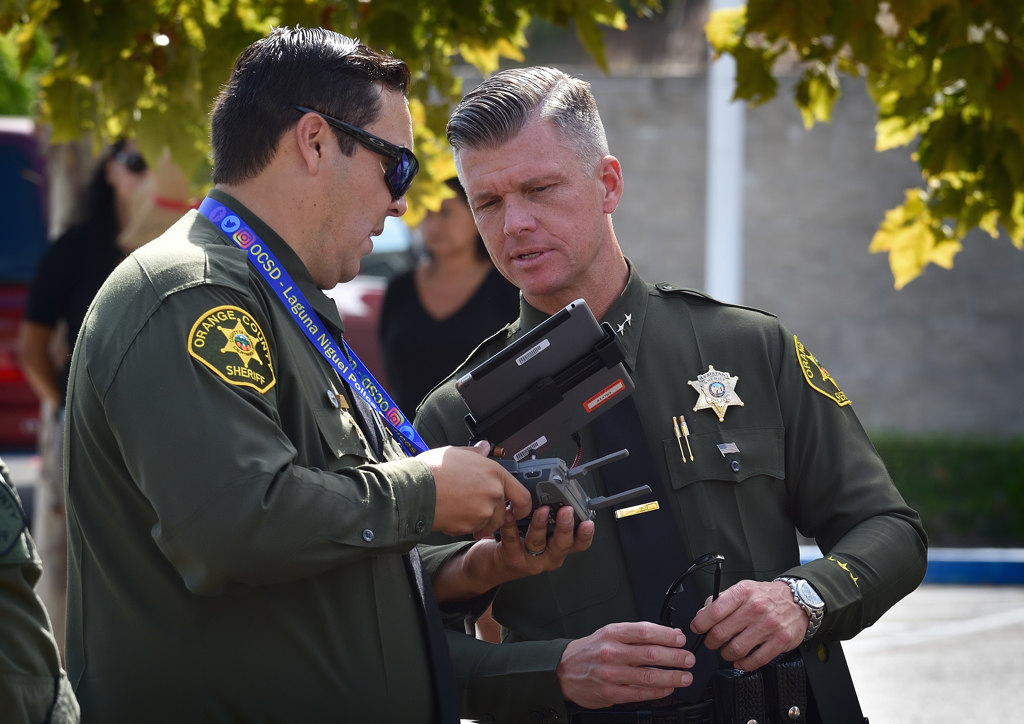
OCSD Dep. Kyle Ishii, left, shows Assistant Sheriff Jeff Hallock how special software maps out the scene of an investigation.
Photo by Steven Georges/Behind the Badge
“With any resource in law enforcement, the primary goal is to protect the citizens of Orange County as well as life and property, including the lives of our own deputies,” Graham said.
“And that’s the expectation with this technology,” Graham added. “Hopefully, we can get a vantage point for officers on scene to make it safer and identify any hazards that can be mitigated.”
Balancing the public’s privacy rights with the public safety benefits of the program, the Sheriff’s Department will use this new technology for specific missions that would benefit from the unique perspective of a UAV, Graham said.
“All missions will be approved by a unit supervisor prior to deployment, and UAVs will not be used for missions that would violate the privacy rights of the public,” Graham said.
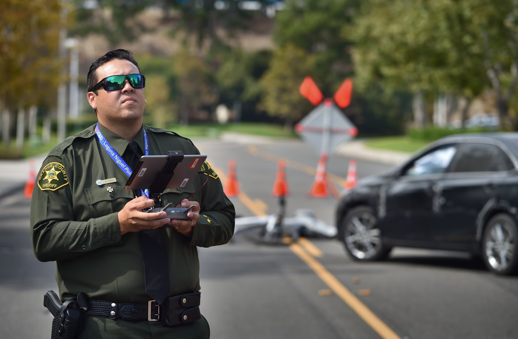
With a simulated car accident behind him, OCSD Dep. Kyle Ishii demonstrates how a UAV can be used with professional mapping and photogrammetry software to survey an area of investigation.
Photo by Steven Georges/Behind the Badge
He added the UAV is an “enhancement tool” that can be used for a variety of scenarios including post-incident crime scene preservation, response to hazardous materials spills, search and rescue operations, public safety and life preservation missions, and disaster response and recovery. A pilot also may be called out to assist other local, state and federal agencies, as one did with the Santa Ana SWAT call.
Ishii took around 150 photos of the mock crash scene, including a series from about 70 feet above the ground and another series about 15 feet above the ground.
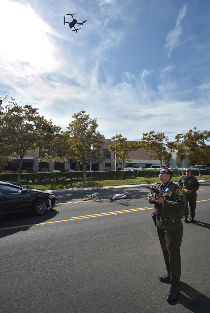
OCSD Dep. Kyle Ishii flies a UAV over the scene of a simulated car accident as professional mapping and photogrammetry software measures the distance between each point of interest, increasing accuracy and saving time. The old method involved measuring everything from the ground.
Photo by Steven Georges/Behind the Badge
Ishii pre-programmed the shots taken from the higher vantage point, and he manually took photos for the closer shots.
“Not only is this going to provide a safety net,” Kahala said. “It’s highly cost effective, and it allows for a quicker response. This program will give the Sheriff’s Department another asset to help protect the residents of Orange County.”
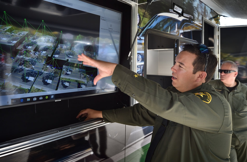
OCSD Dep. Kyle Ishii shows how special software accurately maps out distances of each point of interest of an accident scene.
Photo by Steven Georges/Behind the Badge


